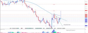
The natural gas gap held again today as the December natural gas contract bounced off it and rallied a bit through the day on marginally colder weather forecasts.

Some of the move was weather-driven, as the front of the strip saw the largest gains and parts of the rally coincided with American modeling guidance, but the rest of the strip did decently today as well.

Yet warmer weather risks and declines at the front of the natural gas strip have pulled H/J back down significantly, and it was only able to marginally recover today, indicating concerns about stockpile levels moving through the winter remain relatively lower than they were a few months ago.

However, heading into the day we noted that concerns for the winter were still substantially above average, as only once in the past 6 years has H/J been this wide in the middle of November (and unless weather turns cold it tends to fall off rather quickly from here as well).

Much of that is due to stockpiles being decently below average as we head into the winter season, which as we mentioned yesterday makes the market extremely sensitive to weather changes. Yet long-range weather model volatility is extraordinarily high as models attempt to discern how much cold lingers along the East Coast. For example, the early morning 6z run of the American GFS ensembles showed widespread warmth with only limited cold risk on the East on December 1st (image courtesy of the Penn State E-wall).

The early afternoon 12z run showed substantially more cold risk for the same time, boosting natural gas prices.

It is these kind of run-to-run differences that have been driving much of the natural gas volatility through the week, and are one of the key things we keep an eye on when analyzing the natural gas market.


